

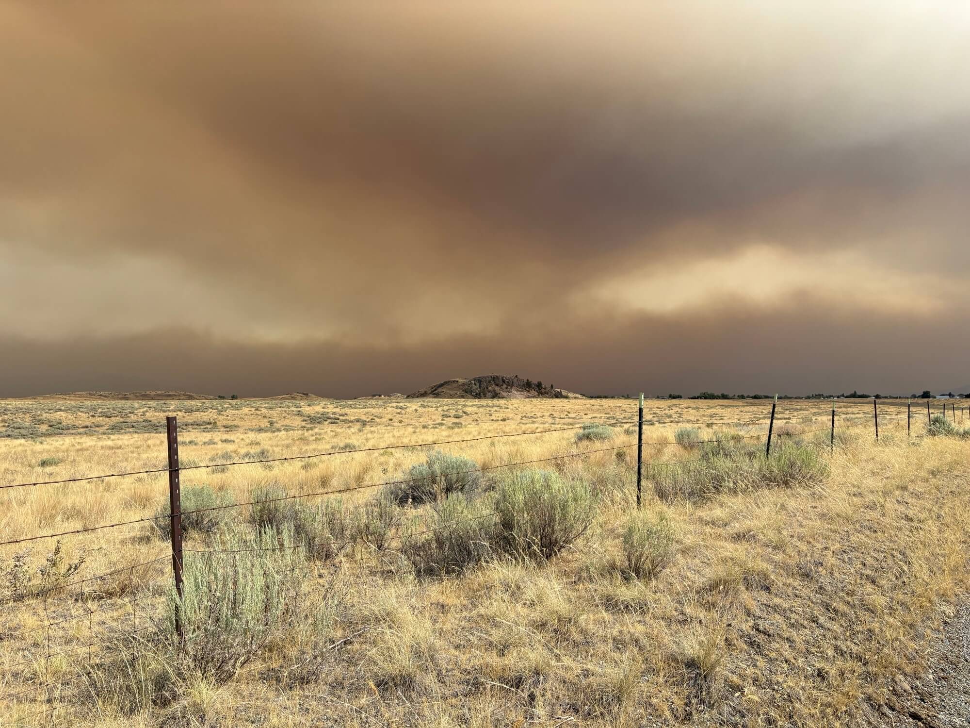
Across Washington, communities are once again facing the very real impacts of wildfire: evacuations, damaged homes and farms, displaced animals, dangerous smoke, uncertainty and loss.
Our hearts are with everyone directly affected, especially communities in eastern and north-central Washington and on and near the Colville Reservation, where fires have burned across landscapes many of our staff, partners, supporters and friends call home.
We are deeply grateful to firefighters, emergency responders, Tribal staff, local officials, volunteers, neighbors and community organizations working around the clock to keep people safe and help those who have been displaced.
Wildfire conditions can change quickly. We’ve gathered the resources below to help people find reliable information about active fires, evacuations, smoke, recovery assistance and ways to support affected communities.
Last updated: August 7, 2026. Please rely on local emergency management and fire officials for evacuation orders and other urgent safety information.
Real-time fire updates
Watch Duty
Watch Duty provides frequently updated maps of active wildfires, evacuation zones, shelters, fire perimeters and other incident information. The Washington State Department of Agriculture also recommends it as a tool for following active fires and evacuation information.
Open Watch Duty
Washington Department of Natural Resources Wildfire Portal
DNR provides information on active wildfires across Washington, including incident locations, acreage, containment and available fire information lines.
Washington DNR Wildfire Portal
Okanogan County Emergency Management
For fires affecting Okanogan County, this is one of the most important sources for evacuation levels, road closures and emergency contacts. The county also provides information for signing up for local emergency alerts.
Okanogan County active incidents and alerts
CalTopo fire map
CalTopo offers a useful map combining recent fire perimeters and satellite fire detections. It can be helpful for understanding the broader landscape, but it should not replace official evacuation information.
View the CalTopo fire map
Washington statewide wildfire resources
The Governor’s wildfire resource page brings together state and county updates, shelter information, emergency contacts, assistance programs and ways to help.
Washington Wildfire Resources
Spokane-area fires
The Spokane area has experienced an especially destructive outbreak of wildfire, including the Old Trails, Fairview and Autumn Lane fires, which prompted widespread evacuations and destroyed hundreds of structures.
For the latest evacuation zones, shelter information and recovery resources, use:
Greater Spokane Emergency Management and Spokane County updates
Washington’s statewide wildfire page maintains direct links to Spokane County evacuation information and emergency updates.
Washington wildfire resources and Spokane updates
Alert Spokane
Residents in Spokane County are encouraged to register for local emergency alerts and follow instructions from fire and law-enforcement officials.
For people who want to assist Spokane-area residents, the state lists Spokane Neighborhood Action Partners (SNAP) as a local organization helping communities affected by wildfire.
Fires on or near the Colville Reservation
Multiple fires have affected lands and communities on and near the Confederated Tribes of the Colville Reservation.
For current conditions and evacuation information, Okanogan County Emergency Management currently lists the Colville Tribal Emergency Operations Center at 509-634-2043.
The Confederated Tribes of the Colville Reservation have also established official wildfire donation locations to make sure supplies reach people who need them.
Current requested items include:
- Blankets and pillows
- Clean clothing
- Diapers and baby wipes
- Personal hygiene products
- Dog and cat food
- Livestock and poultry feed, including hay
- Bottled water and electrolyte drinks
- Coolers
- Air purifiers and humidifiers
- Generators
- Mattresses and furniture
- Reusable duffle bags, totes, storage containers and backpacks
Dronation drop-off locations:
Omak Eagles Nest
1168 Bull Rope St.
Omak, WA 98841
Contact: Leah Cate, 509-634-1409
Colville Service Center / Old Highway Tire
3041 State Highway 155
Coulee Dam, WA 99116
Contact: Desiree Hertenstein, 509-634-1963
The posted donation hours are 8 a.m. to 8 p.m. daily.
Northcentral Washington Fires
The Little Giant Fire is burning in Chelan County in the Chiwawa River drainage of the Okanogan-Wenatchee National Forest, north of Lake Wenatchee. The fire has prompted evacuation notices in the Trinity and Entiat Valley areas and has generated significant smoke across the region.
Because evacuation levels can change quickly, residents and visitors should use Chelan County Emergency Management’s Emergency Incidents Map to check an address and see whether it is within an evacuation zone. Chelan County also recommends Watch Duty for wildfire alerts and InciWeb for detailed incident information.
Chelan County lists a dedicated Little Giant Fire information line at 509-776-6953 and email at 2026.littlegiant@firenet.gov.
Useful links:
- Chelan County Emergency Management: Active Emergencies
- Watch Duty wildfire map
- Washington DNR Wildfire Portal
The Sinlahekin Fire began west of Tonasket in late July and has affected a landscape with tremendous ecological and community significance. DNR and Okanogan County have been coordinating fire response and public information.
For the latest information about fire activity, road closures and evacuation levels, please use:
Okanogan County Emergency Management
Washington DNR Wildfire Portal
This landscape is also familiar and important to Conservation Northwest. The Sinlahekin Wildlife Area has long been an important place for collaborative forest restoration and the careful use of prescribed fire. In 2015, previous prescribed-fire treatments in the Sinlahekin helped firefighters hold portions of the Okanogan Complex.
Right now, however, the priority is the safety of people, responders, wildlife and communities in and around the fire.
Lost pets, livestock and animal assistance
Wildfire evacuations are stressful enough without worrying about where to take animals or how to find one that has gone missing. If you have pets, horses or livestock, evacuate early when possible. Spokane County specifically recommends leaving at Level 2 if you have animals, because loading and transporting them takes extra time.
Northcentral Washington fires
For current animal evacuation and shelter information, check Okanogan County Emergency Management and Watch Duty first. Washington’s Department of Agriculture notes that evacuated livestock and large animals may be housed at local fairgrounds or other temporary locations, but those sites can change as an incident evolves.
The Okanogan County Fairgrounds, 175 Rodeo Trail Road in Okanogan, has horse stalls and RV/camping facilities and can be reached at 509-422-1621; the after-hours manager number is 509-740-9009. The fairgrounds normally accommodates horses, but people should call before hauling animals there during the current fires to confirm emergency capacity and availability.
For lost or displaced livestock, the Washington State Department of Agriculture can help identify animals through brands, tags and other livestock records. WSDA wildfire resources
For people with animals, Chelan County’s emergency planning specifically includes livestock and pets, and county planning documents identify the Wenatchee Valley Humane Society as a partner for helping landowners find safe locations for domestic animals and livestock when evacuation assistance is needed.
Colville Reservation and surrounding communities
The Colville Tribes Emergency Operations Center is coordinating evacuation, shelter and community resources for fires affecting the Reservation. For current evacuation and resource information, call 509-634-2043.
The Tribes’ current wildfire relief effort is also requesting supplies for displaced animals, including dog food, cat food, goat feed, pig feed, bird feed and cat litter.
For people in the Republic/Ferry County area, Forget Me Not Animal Shelter maintains lost-and-found pet listings and asks people to email photos and information about missing or found animals. The shelter is at 49 W. Curlew Lake Road, Republic and can be reached at 509-775-2308.
Spokane-area fires
Spokane County Emergency Management says people with pets or livestock who need evacuation assistance should call 911. Requests can then be routed to the trained Spokane County Livestock Emergency Evacuation Team (SLEET), which works with first responders to move animals safely and reconnect them with their owners.
During the current fires, Spokane County has also established emergency animal sheltering at the Spokane County Fairgrounds, 404 N. Havana St. in Spokane Valley, with access through the red gate off Broadway. Recent emergency information also indicated RV space was available there for evacuees with animals. Because conditions and capacity can change, confirm through Spokane County Emergency Management before heading there.
SpokAnimal has also been providing temporary shelter for pets displaced by the fires. Its shelter is at 715 N. Crestline St., Spokane, and community reports this week indicate it has been taking in evacuated animals and requesting pet food, blankets and towels. Please contact SpokAnimal before bringing an animal there.
For a lost or found pet in Spokane County, the Spokane Humane Society directs people to SCRAPS/Spokane County Animal Control at 509-477-2532 and to Petco Love Lost, which allows people to upload a photo and search reports of lost and found animals.
If you find an animal after a fire
If it is safe to do so, contain the animal and photograph it, but don’t assume it has been abandoned. Fire-displaced animals can travel surprisingly long distances. Have pets scanned for a microchip at a shelter or veterinary clinic and report found livestock to local law enforcement or animal authorities so owners have a central place to look.
For livestock, keep identifying details such as brands, ear tags or unusual markings in your report. For pets, sharing a photo through official shelters and lost-pet databases as well as local community groups gives families the best chance of finding them.
Farmers, Ranchers & Agricultural Producers
For people returning home or beginning to assess losses, recovery can feel overwhelming. Washington State Department of Agriculture recommends documenting damage with photos, keeping records and receipts, contacting insurance providersWildfires can have devastating impacts on farms, ranches, and working lands. Beyond the immediate threat to people and livestock, producers may face damaged fencing, lost forage, crop losses, reduced water supplies, and long-term impacts to soils, forests, and infrastructure. Fortunately, local, state, and federal partners offer resources to help agricultural communities recover and rebuild. early and connecting with local or federal assistance programs.
Washington State Department of Agriculture wildfire recovery resources
Especially useful for farmers, ranchers and people caring for livestock. Information includes documenting losses, livestock health after wildfire exposure, agricultural assistance and recovery contacts.
2026 Wildfire Recovery Resources
Local Agricultural Resources
If your farm or ranch has been impacted by wildfire, these organizations can help connect you with recovery assistance, technical expertise, and practical guidance:
- Okanogan Conservation District
Post-fire recovery assistance, erosion control, and protecting soil and water resources. - Chelan Conservation District
Technical support and conservation resources for landowners affected by wildfire. - Washington State University Extension
Research-based guidance on livestock care, pasture recovery, fencing, forage, and post-fire land management. - Washington State Department of Agriculture Wildfire Resources
Wildfire preparedness information, livestock evacuation planning, agricultural recovery resources, and emergency guidance for producers. - USDA Service Center Locator
Find your local USDA office to report losses and learn about disaster assistance programs.
USDA Disaster Assistance
If your operation has been impacted by wildfire or drought, contact your local USDA Service Center as soon as it is safe to report damages and learn what assistance may be available. Depending on your situation, support may be available for:
- Livestock losses
- Emergency feed and water transportation
- Grazing losses
- Crop, orchard, and nursery damage
- Fence and infrastructure repair
- Emergency and low-interest farm loans for eligible producers
You can also use USDA’s Disaster Assistance Discovery Tool to identify programs that fit your situation.
Insurance questions
Washington’s Office of the Insurance Commissioner can help residents understand wildfire-related insurance claims and coverage. The state wildfire resource page lists its consumer assistance line as 1-800-562-6900.
Long-term recovery in Okanogan County
Okanogan County Emergency Management currently lists a contact for long-term recovery needs: Jessica Farmer, 509-846-5101.
Air quality, smoke and local forecasts
Washington Smoke Blog: local and regional smoke forecasts
The Washington Smoke Blog is one of the most useful resources for understanding what smoke is expected to do next. A partnership of state, federal and local agencies and Tribes, it provides regional smoke outlooks, air-quality forecasts and explanations of how weather and active fires are affecting communities around Washington.
The map includes daily forecast layers, while posts often give more context about expected smoke movement over the next day or several days. Forecasts represent averages, however, so conditions in valleys and communities close to active fires can be considerably different.
Washington Department of Ecology: five-day smoke forecast
During wildfire season, Ecology provides a five-day forecast of expected smoke and air-quality conditions across Washington. It can be especially helpful when deciding when to exercise outside, travel, open windows or plan outdoor events.
Washington wildfire smoke forecast
PurpleAir: hyperlocal conditions right now
PurpleAir can show conditions at individual neighborhood sensors, making it particularly useful in mountain valleys and rural communities where smoke can vary dramatically over short distances.
AirNow Fire and Smoke Map: current conditions and health guidance
AirNow combines regulatory monitors, temporary wildfire monitors and corrected data from participating PurpleAir sensors, and connects AQI readings with public-health recommendations.
For homes without central filtration, a portable HEPA air cleaner or a high-efficiency HVAC filter can significantly reduce indoor particle levels. AirNow also provides guidance for creating a cleaner-air room in your home. If you do not have an air filter, you can make one inexpensively by using a 20x20x2 MERV 13 filter with a box fan. Instructions can be found here. These are effective and inexpensive to make.
DIY Box Fan Filter Instructions
Places to donate
One of the best ways to help is to give directly to trusted organizations working in affected communities. Cash donations can often be used more quickly and flexibly than unsolicited goods.
Colville Confederated Tribes wildfire relief
The Tribe has established official donation sites in Omak and Coulee Dam for supplies needed by fire-affected families and animals. They have also established the Cedar Fund to assist tribal members with wildfire recovery: Cedar Fund Wildfire Recovery Campaign
River Warriors and XaʔXaʔ Indigenous Birth Justice
These community organizations are collecting tax-deductible donations to support wildfire survivors, including assistance with gas cards, grocery/Walmart cards, hotel accommodations, food and hay for displaced animals. Faith Zacherle in Tonasket, 509-631-0460, is a community contact for families affected by the fires. You can donate to River Warriors through Faith’s Venmo account: @faithzacherle76 with a note “for fire relief”
Community Foundation of North Central Washington
The Governor’s wildfire resource page identifies the Community Foundation of NCW as a community-based avenue for supporting wildfire-affected communities in Chelan, Douglas and Okanogan counties. Wildfire Relief – Community Foundation of North Central Washington
Okanogan County Community Action Council
The state also identifies OCCAC as a local resource assisting residents affected by wildfire in Okanogan County. Donate – Okanogan County Community Action Council
Spokane Neighborhood Action Partners
For people wanting to help Spokane-area families, SNAP is among the local organizations identified by the state for wildfire recovery support. https://www.snapwa.org/give/
Taking care of each other
Wildfire is part of living in the Northwest, but that does not make days like these easy.
Behind every perimeter on a map are people wondering whether their home, ranch, animals, favorite trail, community gathering place or piece of family history will still be there when they return. And even far from the flames, weeks of smoke can take a physical and emotional toll.
Conservation Northwest believes that resilient landscapes and resilient communities go hand in hand. During this difficult stretch, we’re grateful for the countless ways people across Washington are looking out for one another.
We’ll continue adding useful, verified resources as they become available.


